
Trunyan Hill is an underrated hike in Bali with amazing views of Mount Abang and the Batur caldera. It looks like a Jurassic landscape!
This trail is located near the popular Mount Batur volcano, but it’s much less crowded and most foreign tourists don’t even know about it.
I did the hike recently and it was a wonderful experience, with plenty of challenge and some of the best scenery on the island.
This guide will explain all about how to do the hike and what to expect!
Quick Facts*
- Distance: 5.8 kilometers (3.6 mi)
- Elevation Gain: 770 meters (2,526 ft)
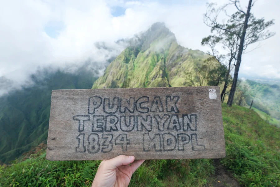
- Max Altitude: 1,820 meters (5,971 ft)
- Duration: 4 – 6 hours
- Difficulty: Moderate / Hard
*These are the roundtrip stats for the hike if you start from Trunyan village
Trailhead: How To Get There
Trunyan Hill is located in the Kintamani area of northeast Bali.
It’s a 1 or 2 hour drive from touristy places like Ubud, Sanur, Canggu or Kuta in south Bali.
The whole drive is paved, but the last part requires a bit of care because the road is curvy, steep, and bumpy with potholes.
There are two possible starting locations for the hike:
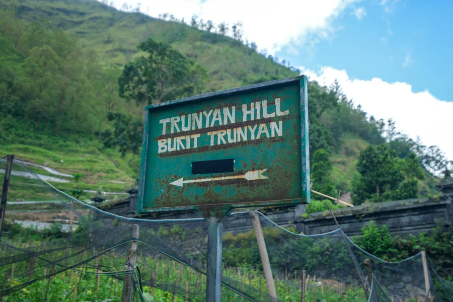
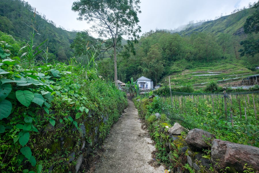
- In Trunyan Village. This is the main trailhead and it’s the one I used. The trail starts from a narrow alley in the middle of Trunyan village, and it’s marked with a sign by the road.
- Above Trunyan Village. This is an alternate trailhead partway up the hill. If you start here, the trail is a bit easier because it shaves off about 2 kilometers of hiking and 200 meters of elevation gain, but it also takes a bit more driving to reach since it’s outside the caldera.
What To Expect: Hiking Trunyan Hill
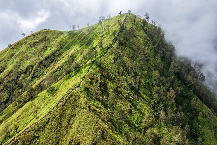
The hike to Trunyan is steep and challenging, and there are plenty of opportunities to hurt an ankle if you aren’t careful, but it’s never dangerous in terms of drop-offs.
Bug spray is a must: there are some mosquitoes in the forest, and I encountered hordes of flies on the hilltops. They’re aggressive and they can bite! Kintamani is the only place in Bali where I’ve seen such annoying flies.
On the plus side, I went on a Saturday and the whole trail was surprisingly uncrowded. It was a really nice contrast to the huge crowds at Mount Batur nowadays. I only met one foreign couple with a guide, and a handful of friendly local teenagers.
The steeper sections of the trail have some ropes to grab. They aren’t necessary, but they can be helpful if you want to give your legs a break.
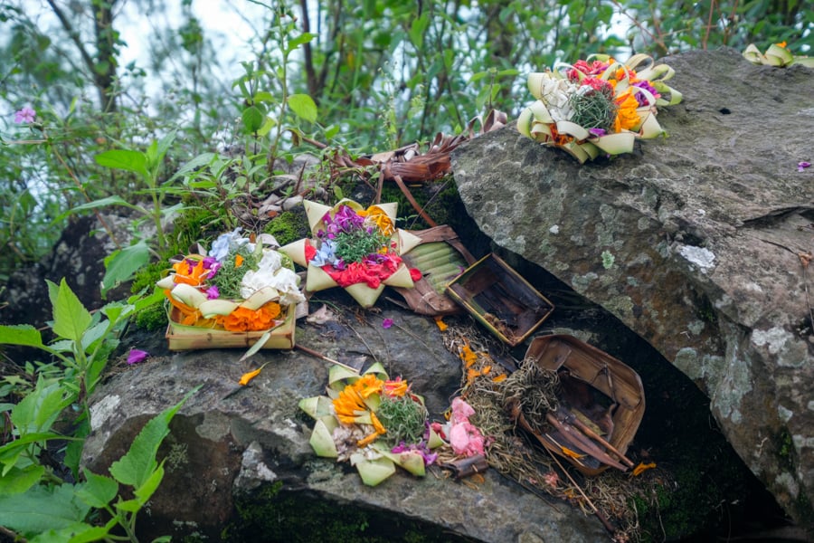
As I climbed, I could hear the faint sounds of Hindu ceremonies and prayers drifting from the village below, adding an interesting ambiance to the trek.
It took me about 2 hours to reach the top of Trunyan Hill because I stopped a bunch of times along the way. A faster hiker could do it in 1.5 hours, but I think most people can expect to take 2-3 hours.
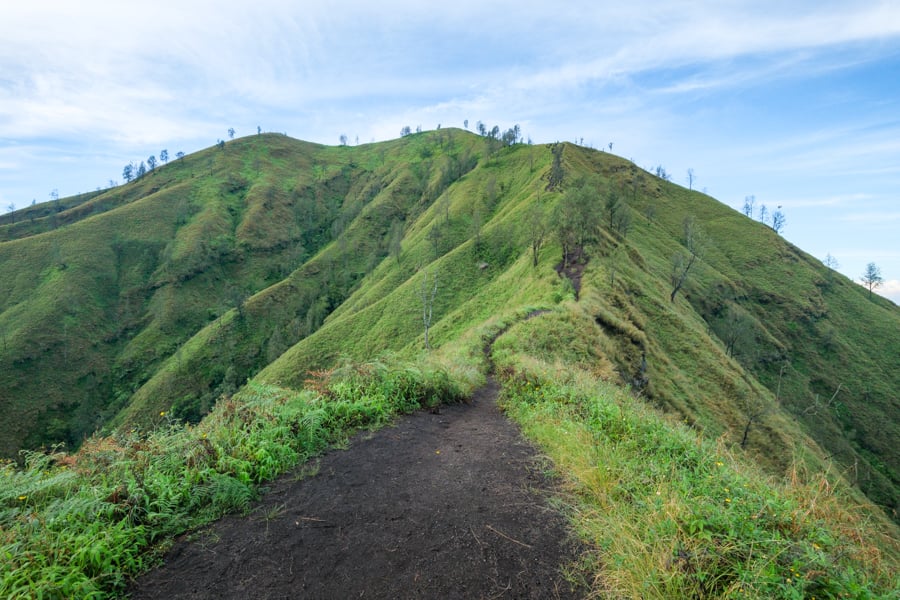
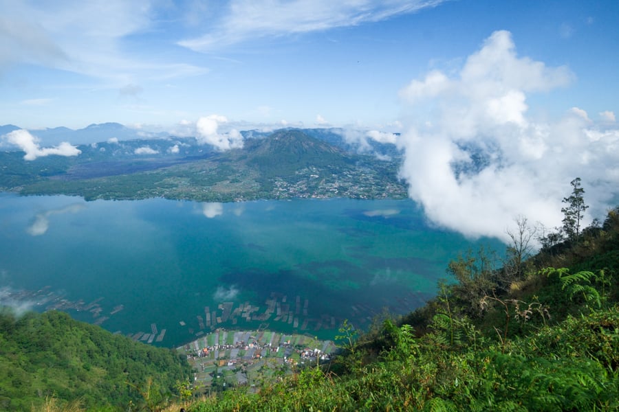
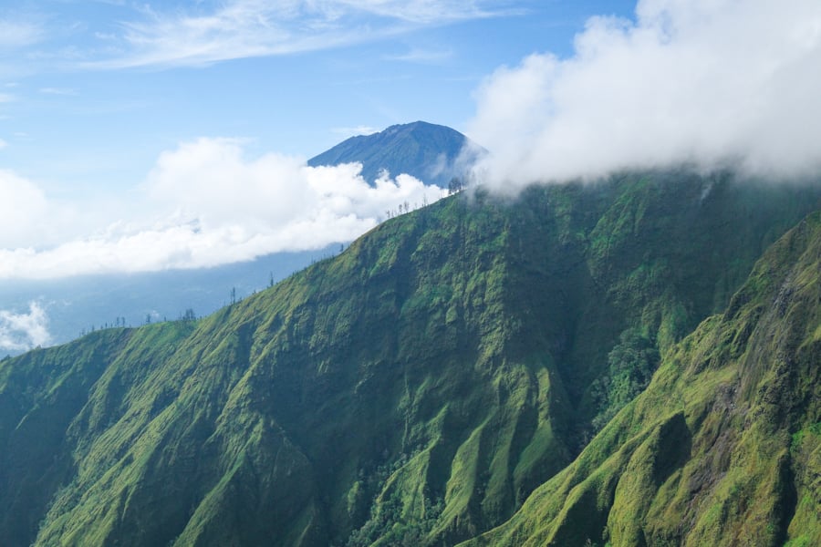
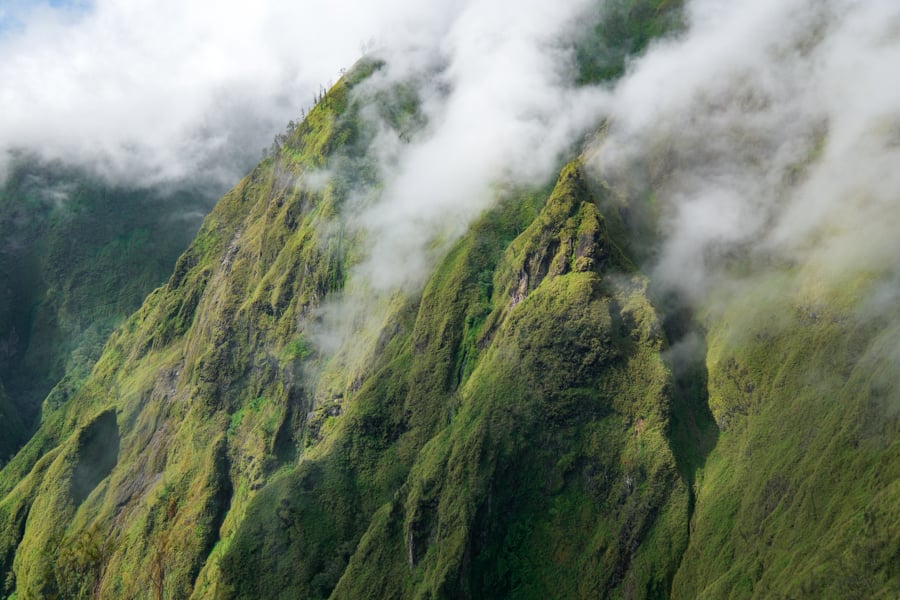
The hilltop has stunning 360 degree views of Mount Abang, Lake Batur, and even Mount Agung in the distance.
My favorite part is the huge cliff wall of Abang, and the valley below. It looks like the Torean valley at Mount Rinjani.
- Part 2: Hiking Mount Abang
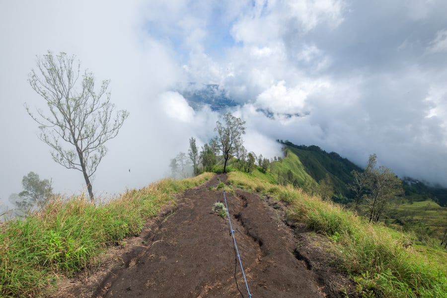
After you reach the top of Bukit Trunyan, if you still have energy and want to keep going, you can hike all the way to the summit of Mount Abang, the 3rd highest mountain in Bali.
The trail does get more sketchy after this point, so be very careful and watch your step. There are huge drop-offs on both sides of the trail, and a local hiker fell and died here in 2024.
In any case, you should at least go until you reach the saddle between Trunyan and Abang, because it has some of the most amazing scenery of the whole hike.
Entrance Fee
As of 2025, there’s no entrance fee for the Trunyan hike, but they ask for a donation at a small registration booth near the trailhead. I gave 30k Rupiah and that was fine.
A guide is not required and no one asked me to hire one, but that could change at any time, especially if the hike becomes more popular.
The Kintamani area is notorious for mafia-style scammers who force you to hire a guide at places like Mount Batur and even Mount Abang, so it may be only a matter of time before they try to make the same rule for this hike.
Best Time To Go
The best time to do this hike is during Bali’s dry season, which generally lasts from April to October.
I went in mid-April and that seemed perfect. The trail was not too wet or muddy, but also not too dry or dusty.
As for crowds, the trail usually isn’t very busy, but I’d try to avoid Indonesian holidays.
In my opinion, the best time of day to go is at sunrise. I started a bit on the late side, and when I go next time I’ll make sure to get there earlier.
I left Sanur at 5 AM, arrived at the trailhead at 7 AM, and reached the summit of Trunyan at 9 AM. That worked, but I missed the sunrise and barely beat the clouds that tend to cover Kintamani after morning.
If you want to stay closer to the hike, there are also some nice hotels and homestays in the Kintamani area, that way you can get an early start without sacrificing too much sleep.